Methil Heritage Trail............under construction
1 Heritage Centre 2 Swan Court 3 Wonderstore 4 St Andrews Square 5 National Bar 6 Methil Brae 7 Station 8 Modo 9 Swan Court 10 Wellesley Colliery 11 Denbeath 12 Gaety Theatre 13 Memorial Park 14 Methil Parish Church 15 Bayview Crescent 16 Fisher Street 17 Methil Primary School
Methil has seen many changes, especially over the last hundred or so years. First of all the town experienced a massive boom based upon two foundations - the large expansion of Fife's coalfields and the rapid development of Methil's docks and coal exporting facilities. The forty years prior to 1921 saw a six-fold increase in population to over 20,000. Methil continued as a thriving centre of industry and commerce during the middle years of the 20th century. However, since the Second World War the area has increasingly had to cope with the effect of a terminal decline in the coal industry and find ways of adapting to its changed circumstances. The purpose of this trail is to highlighting some of the interesting buildings and places in the town and to show a little more about how Methil has changed and developed over the years.
Click thumb nails to see old images

Please take care when crossing the roads along this trail.
Start the trail from Methil Heritage Centre, 272 High Street.
1. The Heritage Centre building was originally a Post Office, built in 1936 to replace the one in Commercial Street.
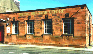
 Monogram
On the front wall you will see the monogram of King Edward VIII — a rare feature as he reigned for just eleven months before abdicating in December 1936 to marry the American divorcee Wallis Simpson.
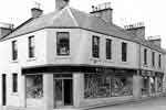
2. Walk up the High Street in the direction of the large tower block. The first shops you pass on your left stand on the site of Methil's first Co-op, which was built in 1892 and destroyed by fire in the 1930s.
 Methil Exservicemens club
The Ex-Servicemen's Club now stands on the corner of what was once one of the busiest parts of town. Commercial Street (formerly Sandy's Wynd) has now been completely demolished and redeveloped, but at one time housed a wide variety of shops.
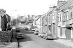
3. Carry on up the High Street. The opposite side of the High Street has also been extensively redeveloped in recent years.
Before these houses were built in the early 1980s the whole of this row consisted of all types of shops with houses above.
4. Set back from the road you will see St. Andrew Square.
 St Andrews Square
This attractive housing development was built in the late 1930s on the site of Lindsay Square, a notorious slum with earth floors and no internal plumbing.
5. Walk up to the end of the High Street.
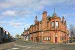 National Bar
  Weather vane
The red sandstone building was built in 1907 as a public house, the National Bar, you can see the date cast into the guttering. Latterly it was named Jamie's Bar until a serious fire in 1990 forced its closure. Unfortunately the fire has also meant the loss of the Bar's fine Art Nouveau interior decoration. The building has since had extensive renovation and been turned into flats.
6. The road up the hill to your right is Methil Brae, one of the town's most ancient roads.
It was originally used to transport coal from the mines in Kirkland to Methil Harbour. In 1785 two miles of wooden rails were laid along the route and coals were hauled along in wagons drawn by ponies. The road to the left is Station Road.
7. Take care crossing the main road. Through the opening to your left can be seen the original railway station building.
 Barclays yard
It was opened in 1887 to coincide with the opening of Methil’s first dock in that year. The line from Thornton closed to regular passenger traffic in 1955 and closed completely in 1966.
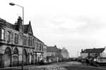
8. Follow the main road around the corner, again towards the large tower blocks.
The large building on the left is known as the Cairn Greig Mansion. It was originally built as a lodging house for navvies employed in the building of Methil's final and largest dock (Number 3, opened in 1913), The building's name derives from the three men who lived in the houses opposite. They protested so strongly about the new building spoiling their view that the builder Adam Stewart saw fit to christen it in their honour: Mr Cairn, Mr Greig and the minister who lived in the Manse, hence 'Cairn Greig Mansion.'
9. Keep following the main road.
 Swan Court & Memorial Court
The two twelve storey blocks and adjacent houses were built in 1970 on the former site of the Railway Buildings - tenement blocks built by the North British Railway for railway and dock employees in 1897.
10. The area to your left as you walk up the hill has been used for oil rig manufacture and now re-newable energy products like wind turbine blades but was previously the site of the Denbeath Colliery (1872-1905) and then the Wellesley Colliery (1905-1967),
 Rig Yard
  Buckhaven Links
To make space for sidings and dumping of pit refuse at the Wellesley a whole village - the Links of Buckhaven -was acquired and demolished around 1910. The residents were re-housed in Buckhaven, and Wellesley Road built to reconnect Methil and Buckhaven.
11. At the top of the hill, turn right along Wellesley Road. This part of the town is known as Denbeath, and was largely developed after 1905 to provide housing and amenities for miners employed at the Wellesley pit.
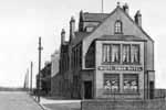
Pass by the White Swan Hotel, which was built in 1906. When the foundations were dug workmen uncovered a bronze age cemetery containing a dozen graves. The Hotel takes it name from the swan on the coat of arms of the Family of Wemyss.
12. The building which now houses Maxwell’s pub was originally the Gaiety Theatre, built in 1907.
It was converted into a cinema in the 1920s and became known as the Western Theatre, closing in 1973. It re-opened briefly as Rick’s Videotek prior to being turned into a public house. The building behind was once the Savoy skating rink, which opened in 1909.
13. Continuing down Wellesley Road you will reach Memorial Park.
 Memorial park
This was once known as Shepherd's Park and between 1892 and 1903 was a 9 hole golf course. It was renamed Memorial Park after the War Memorial was erected in 1922 to commemorate the dead of the First World War. The statue depicts a soldier of the Black Watch regiment. The line of trees on the roadside were planted by local schools to mark the coronation of King George VI in 1937.
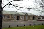 Methil library & council offices
Across the road can be seen Methil Library which moved here from Denbeath in 1935,
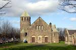
14. Next to the park is Methil Parish Church, built in 1926 to replace the original which stood in Station Road.
Continue past the church until you meet Methil Brae. Captain George Moodie, the first Captain of the Cutty Sark, retired to Methil in 1891 and stayed in "The Anchorage", which you can see here near the top of Methil Brae.
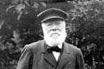 Captain George Moodie
 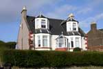 The Anchorage
Captain Moodie was the first president of Methil Bowling Club in 1900.
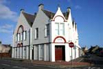 Jax Health Club,formerly Methil Bowling Club
15. Continue along Wellesley Road.
 Bayview Crescent
Opposite the bowling green is Bayview Crescent, the first municipal housing in Methil, built in 1920 under the Addison Scheme.
16. Turn right and walk down Fisher Street.
 Miners institute
On your way you will see the Miners' Institute, which opened in 1927 for the social and recreational use of miners and others. Since 1976 it has been Methil Community Education Centre.
17. Turn left at the bottom of Fisher Street.
 United Free church
  Methil Primary School
A United Free Church and the original Methil Police Station stood in this area until their demolition in 1984. The area directly opposite the Heritage Centre, now occupied by flats, was the site of Methil Public School from 1893 to the early 1970s.
The trail ends back at Methil Heritage Centre where you can enjoy some well-earned refreshments in the tearoom, browse around the shop or see one of the regularly changing exhibitions.
Methil Heritage Centre (Museum of Levenmouth)
272 High Street
Methil
Fife
KY8 3EQ
Tel: 01334 659339 Fax: 01333 422101
Top of page - Download map/trail (5mB) - Methil Heritage Trail 2
